Yorkshire flood warnings: River levels rise following snowfall making way for dozens of flood warnings and alerts

Although the snow warnings have been lifted and much of it has melted across the region, it has made way for several “act now” flood warnings in Yorkshire.
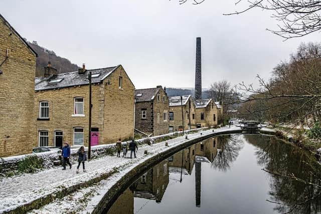
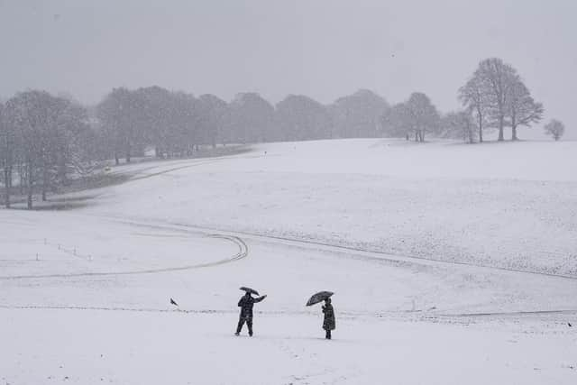
On Thursday (Feb 8), a blanket of snow settled across Leeds, Bradford, the Moors, York, Sheffield and many other county areas, leaving traffic and travel chaos, and even school closures.
Advertisement
Hide AdAdvertisement
Hide AdToday (Feb 11), seven flood warnings and 21 flood alerts across Yorkshire are in place.
A flood warning means you need to act: flooding is expected. You should do all the actions for a flood alert, but also:
- move vehicles to higher ground if it’s safe to do so
- move family and pets to safety
- move important items upstairs or to a safe place in your property, starting with cherished items and valuables, then furniture and furnishings
- turn off gas, electricity and water supplies if it’s safe to do so; never touch an electrical switch if you’re standing in water
- if you have property protection products such as flood barriers, or air brick covers, use them now
- keep track of the latest flood risk situation
Levels in the upper River Hull catchment remain high following recent rainfall and high groundwater.
Areas most at risk include the River Hull and its tributaries at Frodingham, Hempholme, Wilfholme and Burshill, including Roam Drain.
Advertisement
Hide AdAdvertisement
Hide AdA flood warning is in place for North Cave Beck at North Cave.
Areas most at risk include Properties on Denmark Rise, Mill Lane, Church Street, Blanshards Lane, Townend Lane and Newport Road.
People are advised to avoid using low-lying footpaths and any bridges near local watercourses and do not attempt to walk or drive through flood water.
Levels are currently high on the lower River Derwent and are expected to continue rising due to heavy rain overnight. Areas most at risk include Buttercrambe Mill at Buttercrambe Bridge.
Advertisement
Hide AdAdvertisement
Hide AdFlooding is forecast to affect locations near the River Derwent, with low-lying land expected to be most affected, particularly around the Weir Caravan Park at Stamford Bridge and properties at Kexby Bridge.
River levels are rising on the River Foss upstream of Yearsley Baths due to yesterday's heavy rainfall (Feb 10).
Areas most at risk include homes and businesses from Strensall to Yearsley Baths, with low-lying land to be most affected.
York is, once again, at risk of flooding due to rising river levels of the River Ouse.
Advertisement
Hide AdAdvertisement
Hide AdAreas most at risk include properties on King's Staith in York and riverside areas through York from Lendall Bridge to Millennium Bridge, properties along Queen's Staith, on South Esplanade, Friars Terrace and Tower Place.
St George's Field carpark and Rowntree Park are also at risk of flooding.
21 food alerts are also in place across areas of the county including:
- Burstwick and Keyingham Drains
- Holderness Drain
- Humber tributaries
- Lower River Ancholme
- Lower River Derwent
- Lower River Don catchment
- Lower River Nidd catchment
- Lower River Ure
- North Holderness
- Osbaldwick Beck and Tanghall Beck
- River Foss
- River Foulness and Market Weighton catchment
- River Hull Central catchment
- River Rye catchment
- River Seven catchment
- River Wiske and other tributaries of the River Swale
- Tidal River Ouse from Naburn Lock to Selby
- Tidal Trent for riverside areas from Gainsborough to the Humber confluence
- Upper River Derwent
- Upper River Hull catchment
- Upper River Ouse
Comment Guidelines
National World encourages reader discussion on our stories. User feedback, insights and back-and-forth exchanges add a rich layer of context to reporting. Please review our Community Guidelines before commenting.