Hebden Bridge cartographer Christopher Goddard on why it's time to wander West Yorkshire's woods


Cartographer Christopher Goddard isn’t particularly fussed about the reopening of bars and restaurants.
The Hebden Bridge man is much more interested in the brilliant bloom of nature experienced in recent weeks.
Advertisement
Hide AdAdvertisement
Hide AdBecause that means it’s the perfect time to explore Yorkshire’s large swathes of woodland, a subject he’s traversed widely enough to have now published his latest volume of hand-drawn routes and information for people wanting to investigate these parts of the region.
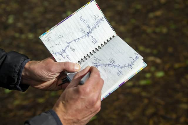
The West Yorkshire Woods Part II: The Aire Valley is an original cartographic guide covering areas spanning from Castleford to Silsden, taking in parts of Leeds, Bradford and its neighbourhoods of Shipley, Bingley and Keighley.
As he writes, within and between urban areas “is a surprising abundance of wooded landscapes, from grand parks and plantations to swathes of ancient coppiced woodland”.
What he aimed to do is map them out and provide a catalogue of information about their rich histories along with details about flora, fauna and fungi that can be discovered.
Advertisement
Hide AdAdvertisement
Hide AdGoddard tells The Yorkshire Post: “I’d say that the woods provide a unique backdrop to West Yorkshire’s urban landscape, whether they’re engulfing former mill sites or weaving their way between our suburbs. They remind us of the nature that surrounds us and are the easiest way to find some escape.
“It’s particularly noticeable at the moment as we’ve had an explosion of greenery in the last couple of weeks and I’ve felt my spirit lifted by this (rather than any lifting of lockdown restrictions) - it’s hard not to take even a brief walk through a wood at the moment and not be uplifted.”
Sheffield-born Goddard grew up in Oughtibridge by the woods of the Upper Don Valley, and with the Bradfield moors on the edge of the Peak District just a short walk away allowing him to take his first forays into map making.He also remembers a family holiday to Corfu as a young man, when he would be wandering the village of Kassiopi, trying to make sense of its terrain.
This love of the outdoors and exploring the very best of it continues today, and is clear to see in his work, as he writes of the mythical lure, and lore, of such environments.
Advertisement
Hide AdAdvertisement
Hide AdGoddard writes: “Believe it or not the English were once thought of by southern Europeans to be rather whimsical and prone to flights of fancy, such was our belief in fairies, fauns, dryads, nymphs, pixies, goblins, trolls and demons. I’m not sure what happened, but if this sense of magic still resides in us I think it is most likely to be brought out by the woods.
“It is easy to find yourself wanting to skip when walking through leafy bowers between twisted oak trees or crossing a carpet of bright bluebells. The woods can excite the child in all of us, and make us want to spend all day building dens and tree houses, chasing each other with spears or bows and arrows or playing silly hide-and-seek games as we used to before we brought too many thoughts into the woods with us.”
He adds that he has always found it easier to imagine a god in the woods than in a church.
Goddard studied geography at St Catharine’s College, Cambridge, and worked as a Rights of Way and National Trails surveyor for the Lake District National Park before settling in Hebden Bridge with his partner, Caroline, in 2006, where they live with their dog, Rufus the Terrier.
Advertisement
Hide AdAdvertisement
Hide AdOn his return, he explored the Upper Calder Valley but found that the Ordnance Survey maps lacked the detail that he wanted, so restarted cartography in earnest.
Since then Mr Goddard, who is in his early forties, has produced numerous books of hand-drawn walking and exploration guides: The South Yorkshire Moors, The West Yorkshire Moors and The West Yorkshire Woods Part I: The Calder Valley, which is now accompanied by the second part.
These have been released through the Hebden Bridge-based Gritstone Publishing co-operative.
And labour of love though it is, filling the gaps of historical details can be difficult, not least because of the uncharted territory of woodland mapping in the north of England over the centuries.
Advertisement
Hide AdAdvertisement
Hide AdGoddard says: “In terms of the historical records, there is a lot written about the woods of the Weald and the Chilterns in the south, but less about woods in the north.
“There is some research on Sheffield’s woods and those in the Lake District, and more recently some work carried out by the Celebrating Our Woodland Heritage Project in the South Pennines, but this has focused mainly on a few particular woods.
“Woods and trees tend to only be mentioned peripherally in a lot of historical work, rather than being the focus, so it is hard to piece the information together to get a good idea how our woodlands have changed over time.
“The disappearance of Farnley Wood is a great example of this - I’ve struggled to find out how, why and exactly when this vast area of woodland just outside Leeds was cut down.”
Advertisement
Hide AdAdvertisement
Hide AdWhat he can say is that after the glaciers retreated at the end of the last Ice Age, in around 9,700 BCE, trees such as birch, hazel, oak and pine returned to the landscape, along with alder in wetter, low-lying areas.
As the climate improved and trees slowly covered most of Britain, he writes, people returned from the continent by the land bridge that still connected us, and these Mesolithic (Middle Stone Age) people slowly spread across the country.
Some occupied the lower Aire Valley (flints have been found at Skelton Grange and Thorpe Stapleton near Temple Newsam), and the higher ground upstream (other flints and arrowheads were found on Bracken Hall Green, as well as widely across Baildon Moor and Rombalds Moor.
The hunter gatherers made temporary clearings in woodland for seasonal camps before moving on regularly - probably spreading the fruit and nut trees they used for food.
Advertisement
Hide AdAdvertisement
Hide AdGoddard believes that in the modern era, though, and despite technology, walkers still enjoy having a physical guide to help them traverse unknown places.
Other maps that Goddard has produced include an illustrated guide to the areas Anne Lister – the inspiration behind BBC television series Gentleman Jack – lived and frequented. He is also working on a book based on the developing England Coast Path.
But with untapped potential in nature the land over, and with a day job as fun as his, he’s unlikely to stop anytime soon.
“This is work, but it doesn’t really feel like it,” he says.
That might just be a wander through the woods in a nutshell.
For more information, visit www.christophergoddard.net.